Project Watershed, a Comox Valley environmental stewardship organization with a unique state of the art GIS/GPS Mapping Center, announces the presentation of a free online printable set of walking maps for Valley Residents and visitors. The simplest way to get to these maps is to visit Project Watershed’s new website at www.projectwatershed.ca, where there is a link in the right hand column. Once on the map page you can click right on the 30+ trails either in the map frame on the right or the list of trails on the left. You can overlay the watersheds that your walk will go through on each trail. A description of your walk will appear on the left. Public Washrooms are indicated as is wheelchair accessibility along with other useful information. If you desire, you can print off individual maps or view on your smart phone or tablet.
Funds to produce these maps were partially supplied by a grant in aid from the Comox Valley Regional District. “When I first came to the Comox Valley in 2000, no accurate maps for walking the area were available” says Paul Horgen, Chair of the Project Watershed Board of Directors. “There were some booklets for sale, but my wife and I use to get lost all of the time because they were not produced through GIS technology and therefore not very accurate”.
The Comox Valley is a key tourist destination on Vancouver Island. Project Watershed feels that these free maps will be a welcomed community resource addition for all visitors and residents who enjoy the beautiful outdoors in the Comox Valley.
Valley businesses can show their support for this endeavor right on the map site by making special arrangements with our Mapping Coordinator, Caila Holbrook at maps.projectwatershed@gmail.com or (250) 703 2871. People who would like to GPS trails not yet on the map or to add GPS information to existing trails can contact Mrs. Holbrook as well.
To keep up-to-date with the resources that Project Watershed is creating and the projects they are working on check our website regularly.
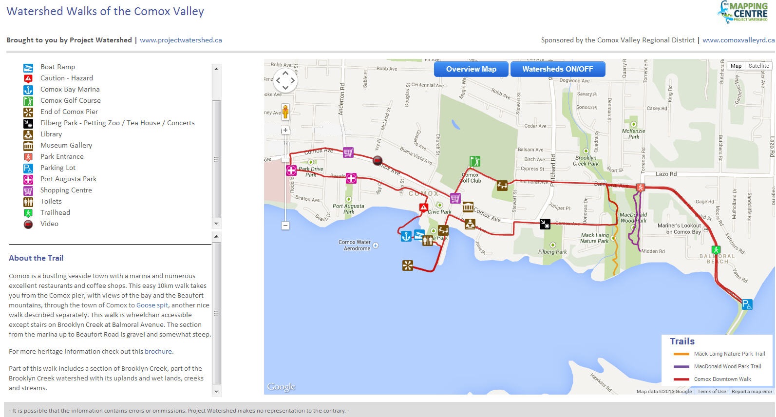 Map Image 10 km walk of town of Comox down to Goose Spit. This map has a video link and is best used with recently published pamphlet Self Guided Comox Walking Tours Comox by the Sea available at the Discovery Centre and businesses in Comox.
Layne and Brenda of 40 KNOTS with Caitlin Pierzchalski ~ L.Stewart