Goose Spit Sign
Spit Formation
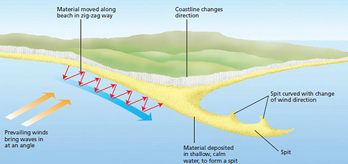
A spit or sandspit is a deposition landform in the formation of a bar or beach which forms when longshore drift reaches a point where the direction of the shore inland re-enters or changes direction more than 30 degrees, such as at the mouth of the K`ómoks Estuary. At this point the longshore current dissipates and can no longer carry the full load. Thus the sediment is dropped or deposited. As longshore drift continues the amount of sediment deposited increases and a sandspit is formed. This process will continue until the water pressure (such as a river) becomes too strong and does not allow sand to deposit. The length and height of the spit is dependent on the strength of wave driven current, the wave angle, and the height of incoming waves. A spit has two important features: (1) the proximal end (or head) is attached to the land and may form a barrier between the sea and estuary, and (2) the distal end (down-drift end or tail) may become long and curved due to the influence of varying wave direction.
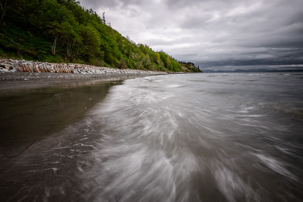
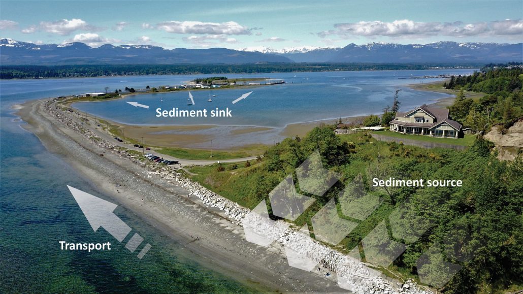
Goose spit was formed and is maintained with sand coming from the Willemar Bluffs. It comes to an end where the water pressure from the Courtenay River carries the sand away from the area. Goose Spit protects Comox Harbour and much of the K’ómoks Estuary.
Information from www.geocaching.com.
Longshore Drift
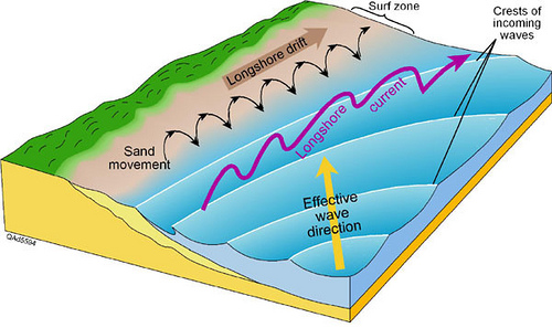
Longshore drift, also known as longshore transport or littoral drift, is the movement of sediments (clay, silt, sand and shingle) when waves meet a coastline at an angle and then backwash perpendicular to the shore, thus moving sediment in a zigzag pattern through the water alongside the beach. Therefore, longshore drift is dependent on the strength and direction of prevailing winds, which drive the force and direction of the waves, and the degree of backwash, which erodes the shoreline and moves sediment down the beach due to gravity.
Sometimes people build walls such as groyns to try and slow down longshore drift. The sand and gravel just ends up piled along the groyn and the beach or landform on the other side of the groyns are deprived of the sand they used to receive. These beaches and landforms, such as spits, will shrink and could disappear over time degrading and reducing important habitat for marine life.
Importance of Beach Habitat
Sandy beaches, such as Goose Spit and those along the Willemar Bluff area, provide foraging and nursery habitat for fish, birds and other wildlife, wave buffering, sediment storage and transport, dynamic response to sea level rise, nutrient mineralization and recycling, water filtration, breakdown of organic materials and pollutants, maintenance of biodiversity and genetic resources as well as human recreation and tourism opportunities.
Only recently has it been known that sandy beaches provide nursery habitat for an important group of fish know as forage fish. Forage fish are small fish that travel in schools such as sand lance and herring. They are food for most other marine species and make up a considerable portion of a whale or salmon’s diet. Some of these fish lay there eggs directly on sandy beaches and are particular about the size of sand or pebbles on the beaches they can use. In 2010, Project Watershed teamed up with Ramona De Graaf of the Bamfield Marine Station and confirmed that Goose Spit is forage fish nursery habitat.
Benefits of Beach Restoration
The video highlights the approach one Orcas Island family took to redeveloping their property that considered sea level rise, beach habitat for people and fish, and protecting their investment into the future.
Media Team
Related Posts
Fall and Winter Forage Fish Sampling
We’re gearing up for the fall/winter season of forage fish sampling!
Mallard Creek Riparian Planting
We will be planting native riparian species along a section of Mallard Creek that we recently cleared of invasive Reed canarygrass.
Fall Planting at Kus-kus-sum
We are looking for volunteers to assist us with planting native trees, shrubs, and marsh plants at Kus-kus-sum this fall!
A New Day for Forage Fish
Project Watershed and the Coastal Forage Fish Network (CFFN) are celebrating Surf Smet Day on October 25th! This adds another day on which to celebrate and raise awareness about beach spawning forage fish as Pacific sand lance are celebrated on a day in December.
Fall Work at Kus-kus-sum
We are looking for volunteers to assist us with weeding out invasive plants to make room for the native plants arriving later this fall!
Forage Fish Survey Techniques Workshop
The Coastal Forage Fish Network (CFFN) is hosting two one-day workshops to introduce development considerations and methods to survey for beach spawning forage fish for projects that may impact beach spawning forage fish.


