Forage Fish Spring 2021 Update and eDNA information
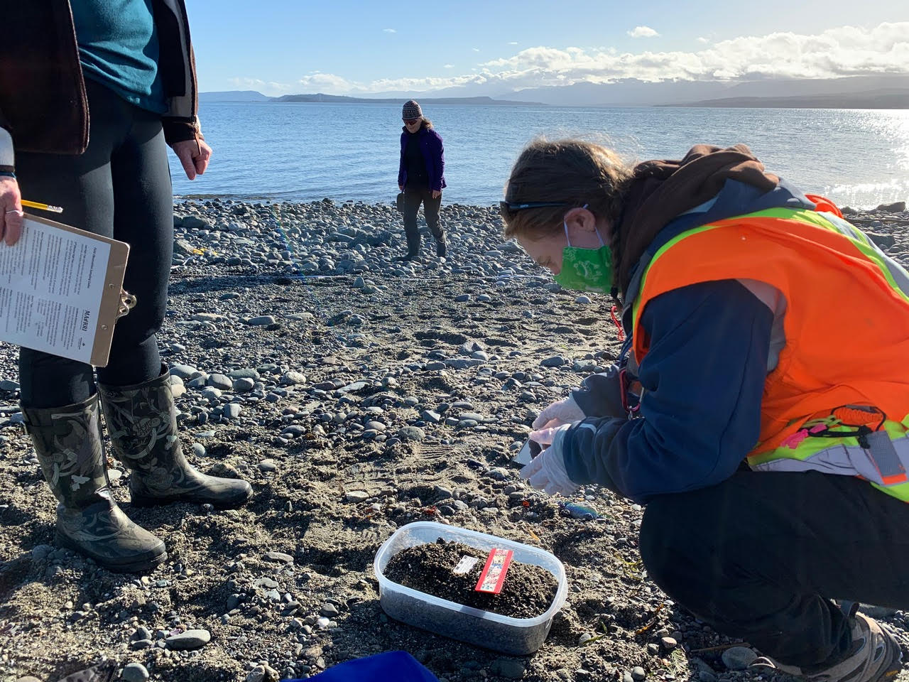
Sediment and eDNA sampling. Photo by C Graves
eDNA samples are bagged separately to reduce contamination. Photo by Virginia East
Here are a few statistics from the last year:
• Between May 2020 and February 2021, we had 60+ amazing volunteers sampling, sieving, vortexing, and counting eggs.
• This totals over 800 hours of volunteer and staff time
• There were 119 field events covering Cortes Island, Hornby Island, Quadra Island, Campbell River, and the Comox Valley
• We sampled new locations this year like Quadra Island, Shark Spit, Royston Wrecks, Campbell River, and Seal Bay, plus our regular core and blitz sites.
• PWS also produced a Forage Fish Brochure and a field day video. We also shared our work through Elder College by teaching forage fish course.
WOW!
One of the things that has become part of our regular sampling activities over the past year is environmental DNA (eDNA) collection. eDNA is DNA left in the sand and water column by organisms such as fish and humans. Examples might include mucus, scales, skin, or fecal matter. Project Watershed has been collecting eDNA to aid with field validation of Pacific sand lance (PSL) and surf smelt (SS) habitat in the northern Salish Sea. Using eDNA markers developed by University of Victoria the sand samples are another way to determine forage fish spawning hot spots.
eDNA is typically collected along with the 4L bulk samples, along a 30 m horizontal transect near the high tide line. Each eDNA sample is collected in a medium, Ziploc quality freezer bag. Approximately 1 cup (250 mL) of sand is collected. Just like the bulk samples eDNA samples are random. eDNA is collected first using best practices to reduce cross contamination of sand from other sites, and to reduce the amount of disturbance to the site. Once samples have been collected, they are kept frozen until which time they can be sent to UVIC for analysis. In the next month or so, we should get results back from UVIC on the set of eDNA samples we have already sent. We are looking forward to seeing where PSL and SS eDNA has been detected and adding these findings to our knowledge base.
Project Watershed would like to thank each and every volunteer for their enthusiasm for increasing the knowledge of forage fish in the northern Salish Sea.
Related Posts
Mallard Creek Restoration Update for 2024
Restoration work in Mallard Creek will continue this year, including invasive removal, restoring connectivity, and trial planting of a new riparian species. Volunteer events starting in September 2024.
Volunteer at Kus-kus-sum Chamber of Commerce Event
We are showing Kus-kus-sum off to businesses in the Valley through a Chamber Business to Business event. We are looking for a few volunteers to assist with this event.
Coastal Plant Monitoring
Get involved with our new vegetation community science monitoring program!
Spring Field Trips
Throughout May and June Project Watershed will be taking elementary school classes out on field trips to learn about estuary and coastal ecology and to assist with planting and plant maintenance.
Working Together to Identify Forage Fish Spawning Beaches
This year marks the 5th year of a partnership between Comox Valley Project Watershed Society and North Island College on a long-term study to examine intertidal spawning habitats of forage fish in the northern Salish Sea.
Glen Urquhart Update – Spring 2024
Latest news from Glen Urquhart restoration progress for spring 2024.


