Pacific Sand Lance Habitat Suitability Model in the Canadian Salish Sea
Why create habitat suitability models?
HSMs are more than just maps though, they are powerful tools that allow us insight to better conserve these species. For example the models allow us to estimate how much suitable habitat exists, and estimate how much is within given jurisdictions such as in protected areas like Provincial Parks, Regional Parks, or in Wildlife Management Areas. Another powerful way we can use models is to understand where habitat may be in areas we can’t easily access like remote Islands. We can also learn from HSMs, because they are built from both the observations of where a species is known to be present, and from underlying environmental information such as fetch, beach slope, or presence of nearby estuaries, HSMs can tell us what are the most important features of a species habitat. For example, in the intertidal sand lance HSM, we learned that the presence of nearby estuaries is the strongest predictor of where suitable sand lance intertidal spawning habitat will be. This tells us that shorelines close to estuaries are really important, and if we want to ensure we have lots of forage food for predators like salmon, whales, and seabirds, it might be wise to protect estuaries, reduce any obstructions like dykes or sea walls that might decrease connectivity, and protect the shorelines near but just outside the estuary from damage or development.

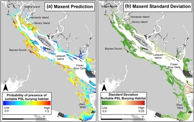
Pacific sand lance subtidal burying habitat suitability model map by Robinson et al, 2021. (a) MaxEnt prediction and (b) standard deviation of the probability of occurrence of suitable Pacific sand lance burying habitat in the Strait of Georgia. Warmer colours indicate a higher probability of suitable sand lance burying habitat. Extrapolation areas identified using the Multivariate Environmental Similarity Surface (MESS) approach are displayed in dark grey.
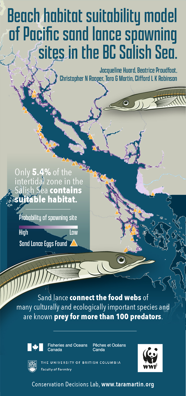
Pacific sand lance (Ammodytes personatus) provide critical support to top predators in marine food webs in the near-shore Pacific ecosystem. Knowledge of where this species occurs is poorly understood, preventing adequate conservation. In order to address this knowledge gap we developed a habitat suitability model that identifies locations where intertidal sand lance spawning habitat, essentially beaches, are likely to occur in the BC Salish Sea. The model was developed using observations (n=90) of sand lance spawning (eggs found on beaches) collected by community scientists from the BC Forage Fish Monitoring Network spawning 19 years, and a suite of pre-existing information and models characterizing environmental conditions (e.g. sediment type, estuary presence, slope, fetch etc.). The resulting model allows us to create maps showing areas where spawning habitat is likely and unlikely to occur. These maps can be used to summarize habitat availability, and can be used directly by managers when assessing proposed projects that might impact the habitat. We estimate that only 5.4% (28 km2) of the intertidal zone of the BC Salish Sea is likely to provide suitable intertidal sand lance spawning habitat, of which only 8% (2.4km2) falls within a protected area. In summary, the Pacific sand lance spawning habitat in the Salish Sea is specific, rare, and vulnerable to change.
In the paper (listed below) you can read the nitty-gritty on how they developed the model, how well it performs, and see maps of where the model predicts spawning habitat across various areas in the Salish Sea (most are in the Supplementary Material).
Written and developed by: Jacqueline Huard, Beatrice Proudfoot, Chris Rooper, Tara Martin, & Cliff Robinson


