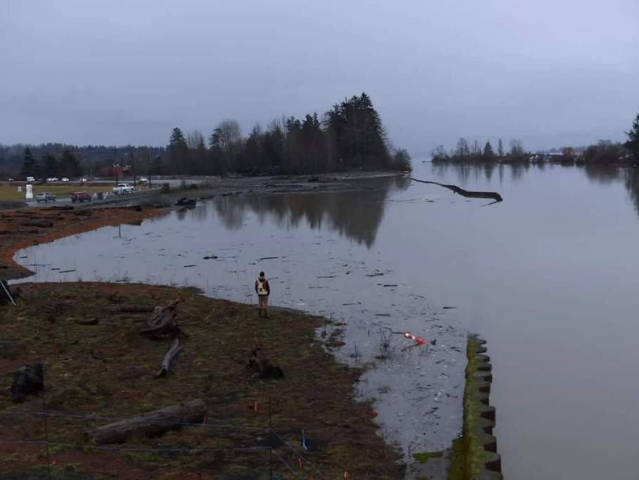
Kus-kus-sum Underwater
The planted areas of the site are already at final grade and the way they handled the water was a very positive example of what we can expect in the future. The berm that runs adjacent to Comox Road was about 0.75-1m above the current flooding levels. This bodes well for our design in future climatic conditions. The site now has more capacity to deal with substantial amounts of water and the upland area of the site is about a meter higher than it was when the site was paved.
Once the wall is removed (date to be determined), the part of the site that was underwater during the latest king tides will be tidally influenced. It will be a diurnally (twice daily) wetted brackish area known as a tidal marsh. Brackish environments have a salinity in between fresh water and ocean water. The plants that we transplanted in that area are salt-tolerant and thrive in these variable conditions. They are fast growing and dormant during the winter months. For these reasons, they should weather this inundation of water well. While there is always a small degree of mortality with new plantings, we do not expect higher than normal rates at this time.
The site is holding the water, which is slowly leaving through the south end. The south end has turbidity and erosion control measures in place, including silt fences, silt curtains, and a rock swale. We are monitoring the turbidity of the water in the river to make sure our site is not negatively impacting the water quality in the river. We are keeping a close eye on our erosion measures and continue to monitor turbidity levels. To maintain the effectiveness of our erosion control measures we plan on reinforcing them before the next king tides at the end of January (Jan. 21-26).
Related Posts
Mallard Creek Restoration Update for 2024
Restoration work in Mallard Creek will continue this year, including invasive removal, restoring connectivity, and trial planting of a new riparian species. Volunteer events starting in September 2024.
Volunteer at Kus-kus-sum Chamber of Commerce Event
We are showing Kus-kus-sum off to businesses in the Valley through a Chamber Business to Business event. We are looking for a few volunteers to assist with this event.
Coastal Plant Monitoring
Get involved with our new vegetation community science monitoring program!
Spring Field Trips
Throughout May and June Project Watershed will be taking elementary school classes out on field trips to learn about estuary and coastal ecology and to assist with planting and plant maintenance.
Working Together to Identify Forage Fish Spawning Beaches
This year marks the 5th year of a partnership between Comox Valley Project Watershed Society and North Island College on a long-term study to examine intertidal spawning habitats of forage fish in the northern Salish Sea.
Glen Urquhart Update – Spring 2024
Latest news from Glen Urquhart restoration progress for spring 2024.


