History of the Kus-kus-sum Site
Ancient History
Pre-European Contact there was a First Nation village located roughly where the present-day Courtenay Airpark is now. The village was called Kus-kus-sum and is the namesake for the present day Kus-kus-sum site. The term Kus-sum means slippery and Kus-kus-sum, means very slippery, likely in reference to the algae that existed on the shores around the village.
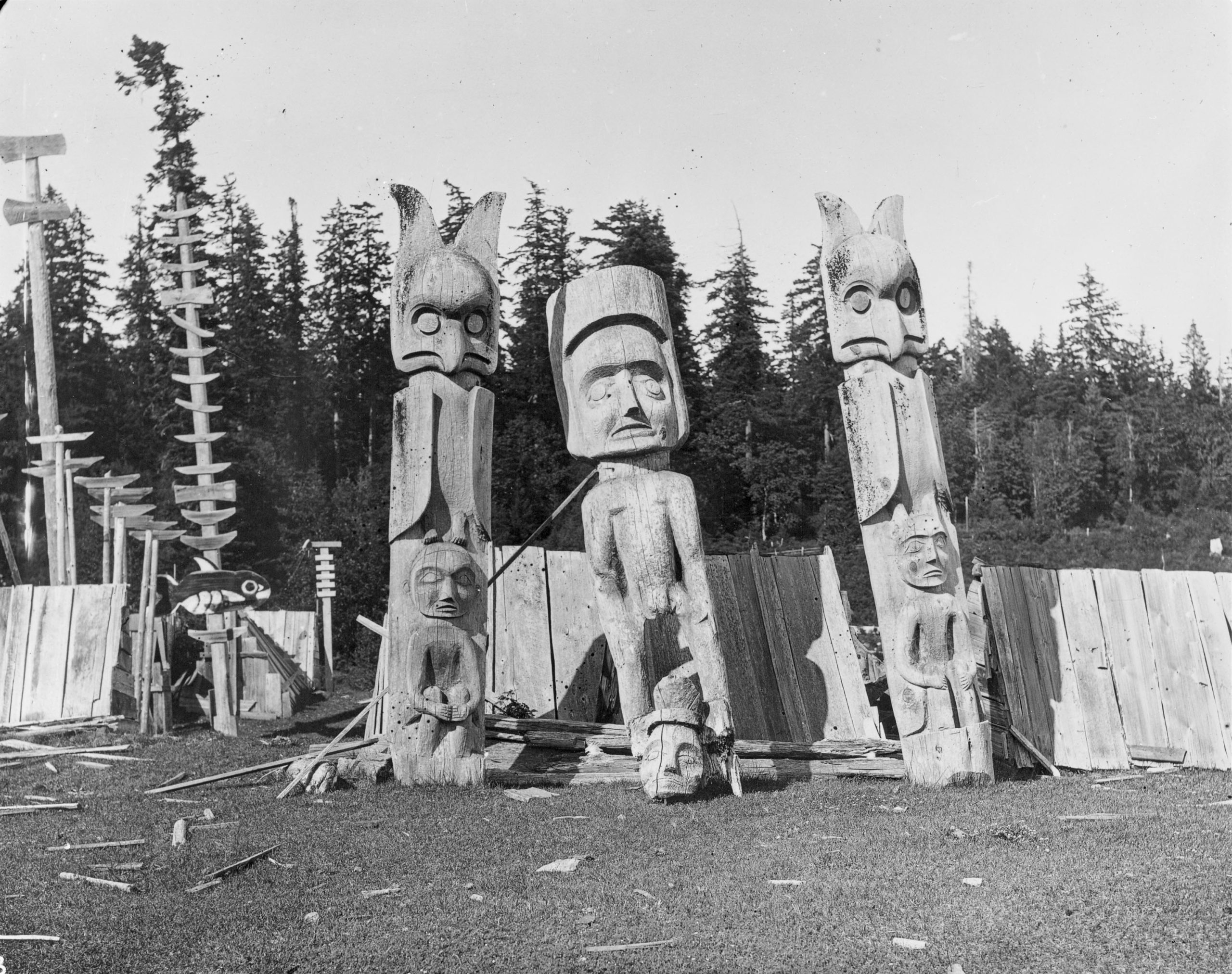
Records from European settlement indicate that the northern side of the river, and likely the current Kus-kus-sum site itself, held mortuary trees and were burial grounds for the Kus-kus-sum village. The presence and location of burial trees was not extensively documented, and they may have extended along the lower part of the river.
The name Kus-kus-sum was given to site by the K’ómoks First Nation in 2017 in remembrance of this ancient village.
Image PN 11915 courtesy of the Royal BC Museum and Archives
Ancient History
Pre-European Contact there was a First Nation village located roughly where the present-day Courtenay Airpark is now. The village was called Kus-kus-sum and is the namesake for the present day Kus-kus-sum site. The term Kus-sum means slippery and Kus-kus-sum, means very slippery, likely in reference to the algae that existed on the shores around the village.
Records from European settlement indicate that the northern side of the river, and likely the current Kus-kus-sum site itself, held mortuary trees and were burial grounds for the Kus-kus-sum village. The presence and location of burial trees was not extensively documented, and they may have extended along the lower part of the river.
Image PN 11915 courtesy of the Royal BC Museum and Archives
1930's
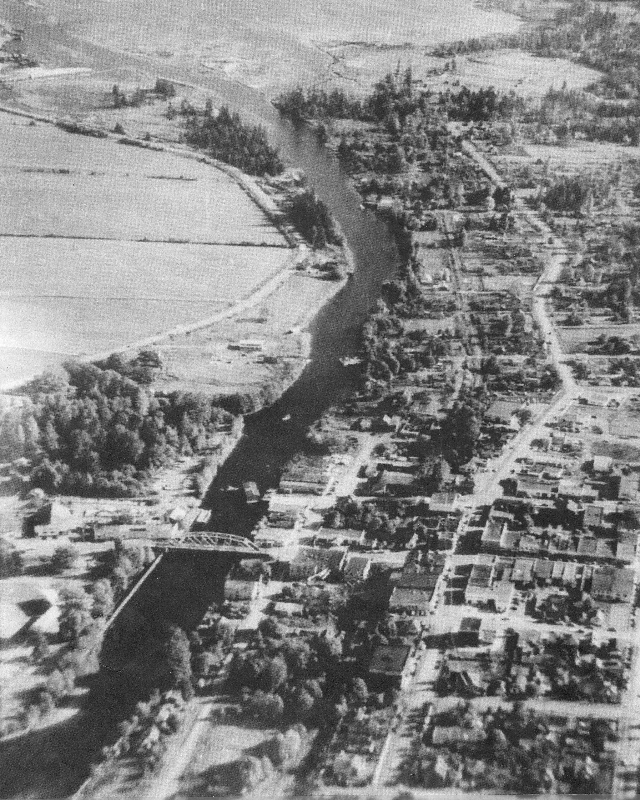
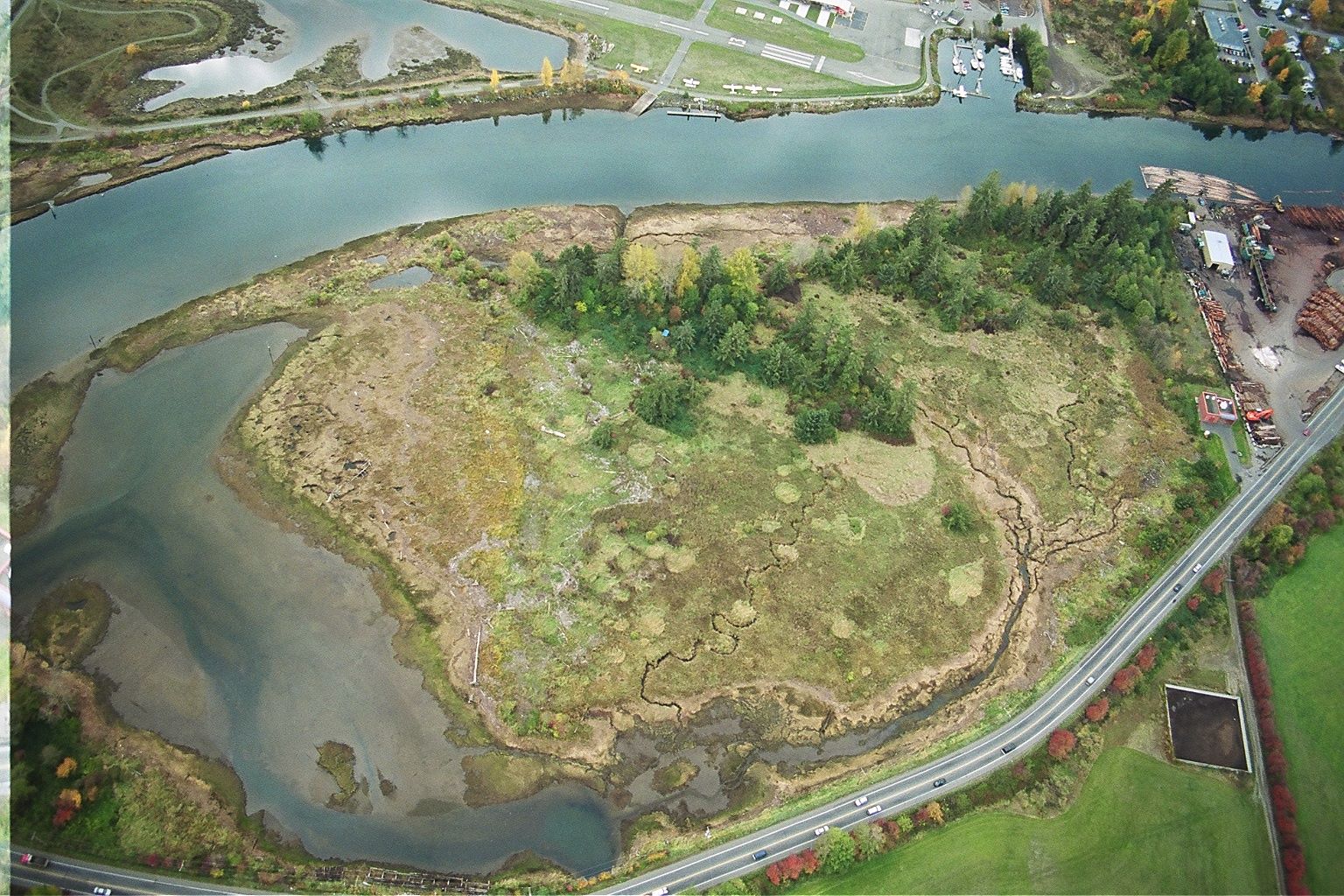
The Kus-kus-sum site is located on the northern riverside of the Courtenay River at the confluence of the river and the K’ómoks Estuary. Historical aerial photographs from the 1930’s show that the site was initially tidally influenced forested riverside/riparian habitat. This habitat type is vitally important for riverine and estuarine creatures and can be seen today in Hollyhock Flats. There is also evidence that a channel crossed Hollyhock Flats and the Kus-kus-sum site, connecting the Dyke Slough to the Courtenay River.
1940's
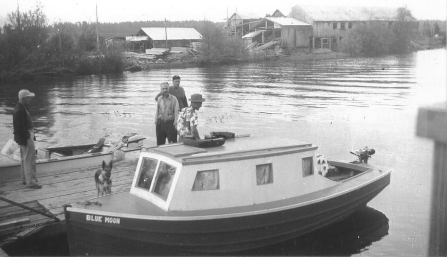
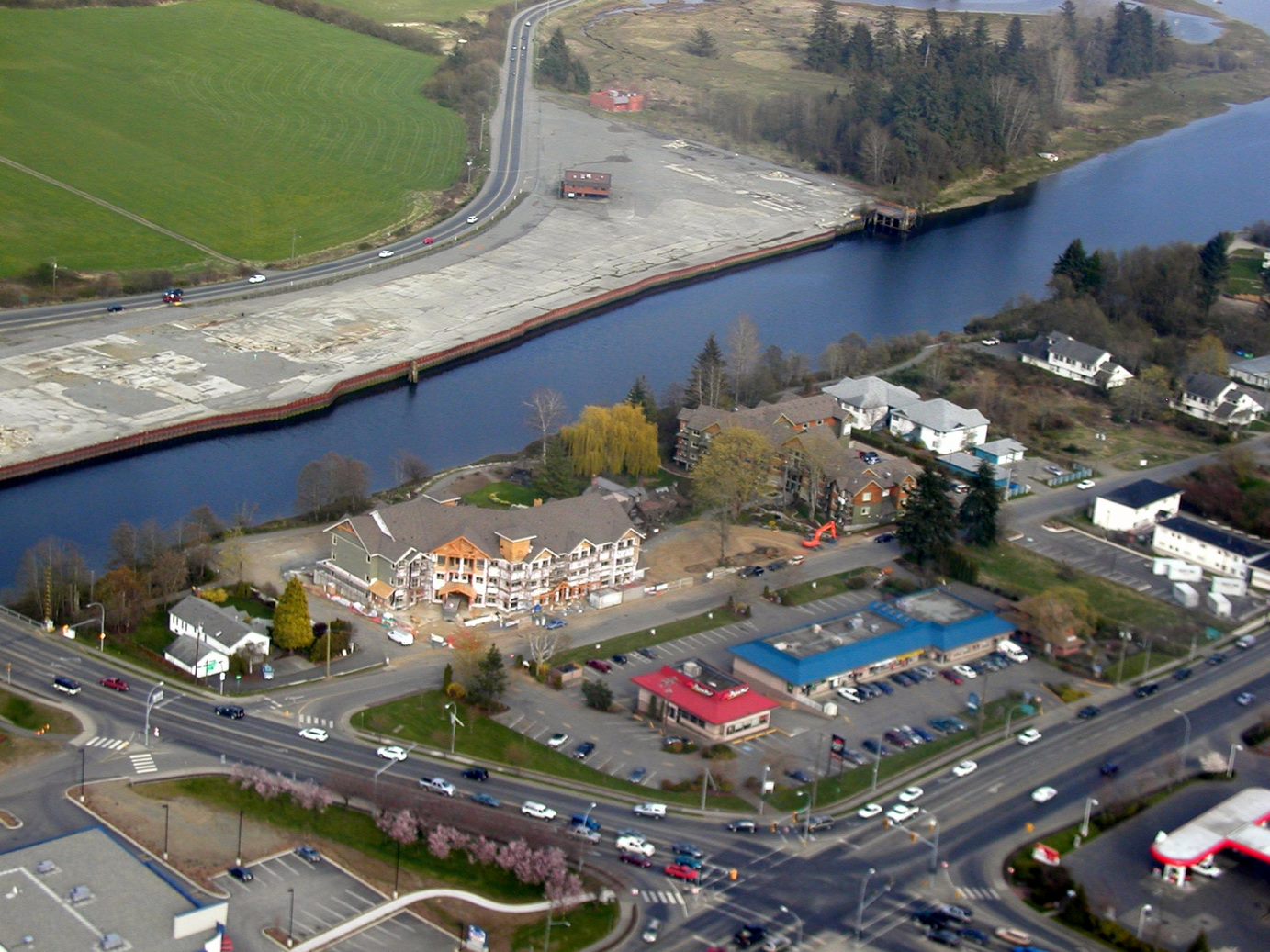
In the late 1940’s a portion of the site was cleared of trees and Fields Sawmill moved its operation to this location in 1949. The sawmill, started in 1947, was previously located on the current site of Arden Elementary school. Moving operations to the riverside allowed the mill to take advantage of the river as a transportation corridor for logs from the upper watersheds.
1960's - 1970's
The Field family retired from the mill in 1969, selling it to Errol Zinck and Bill Phillips, two of their employees. In the 1970’s, the mill changed ownership a few times and ended up in the hands of Primex Manufacturing Inc. At this time, the mill was cutting and selling lumber (yellow cedar) to both the American and the Japanese markets. It employed over 100 people and at its peak that number grew to 160. Primex owned and operated the mill from 1973 to 2001.
1970's
During the 70’s the mill owners filled the marsh area between Courtenay River and Comox Road with whatever materials were available; an assortment of woodchips, oil cans, wire et cetera. Due to the actions of concerned residents the landfilling was halted. In 1974, the Provincial NDP government paid $95,850 for 25.5 acres to preserve the portion of land that was not yet filled. This area, known as Hollyhock Marsh, is located to the south of the Kus-kus-sum site and to this day remains natural habitat and as such provides a template for the restoration of the Kus-kus-sum site.
2000's
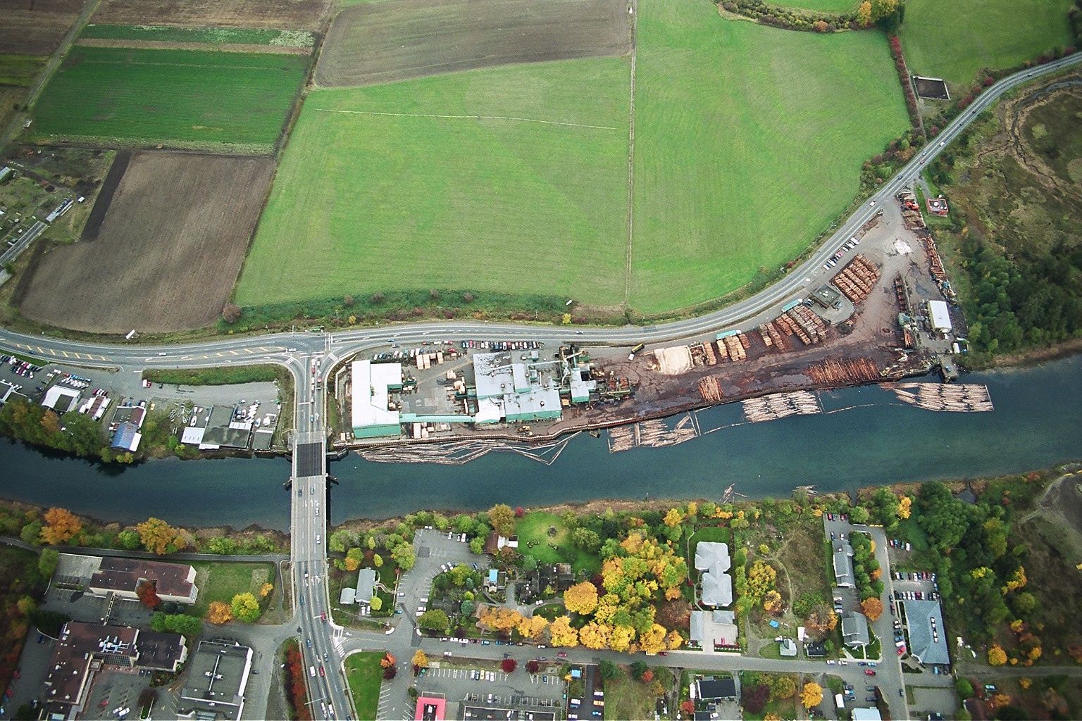
In 2000, Primex started facing economic problems and began employee lay-offs. In 2001, Interfor Corporation bought out Primex and acquired the sawmill. The mill experienced challenging times and in 2003 it operated at a loss of $8 million. It was shut down in 2004. By 2006, it had been decommissioned and all the equipment had been removed. At this time, reclamation of the site was undertaken to safely remove and dispose of industrial toxins. A number of test wells were drilled to determine the quantity and nature of toxic materials in the soils. Toxic soils found were excavated and removed from the site. The holes were backfilled with clean soil and the wells tested again to verify the site was reclaimed. The Province of BC issued a Certificate of Compliance, verifying that the water coming off the site met the standards of the day for aquatic and marine use.
Interfor Corporation put the property up for sale in 2008.
Despite several offers to purchase, Interfor chose to work with Project Watershed and the larger community to achieve a conservation vision for the property. To learn more visit Kus-kus-sum Project History – Project Watershed.


