Forage Fish Habitat Mapping
Local Habitat Mapping Efforts
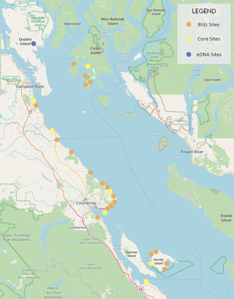
Project Watershed is conducting beach spawning forage fish surveys using visual egg searching methods, and new environmental DNA (eDNA) techniques. The egg search efforts have been conducted primarily with the help of dedicated community scientists who have been surveying northern Salish Sea beaches like Goose Spit, Shelter Point, and Smelt Bay since 2019. Over 30 beaches in the region have been surveyed and tiny Pacific sand lance eggs have been observed on over 20 of these. Although surf smelt spawn on similar beaches and were previously known to be here, their eggs have been suspiciously absent from our samples, and all northern Salish Sea samples. Check out the map below of our beach monitoring efforts. The location of the beaches we surveyed during the 2022/2023 season are shown below. You can hover over each location to see if eggs were found.
Regional Habitat Mapping Efforts
Project Watershed is supporting the development of habitat suitability models (HSMs) of forage fish habitat across BC one region at a time. In 2020-2023 Project Watershed supported the development of a Pacific sand lance subtidal burying habitat suitability model, and a Pacific sand lance intertidal spawning model. Detailed descriptions of these models can be found in peer-reviewed published research papers here and here (open access). You can download the GIS (.tiff) file for the intertidal habitat suitability model or access an interactive map to see if it predicts habitat on your favourite beach on the Strait of Georgia Data Centre. In 2023 we kicked off the next phase of this project to develop HSMs for outer coast of Vancouver Island.