Postdoctoral Research Fellowship
The Spectral and Remote Sensing Laboratory in the Department of Geography at the University of Victoria and Comox Valley Project Watershed Society in Courtenay is seeking one highly motivated, full-time Postdoctoral Research fellow (PDF) to conduct applied research in pelagic modeling of forage fish species within the Salish Sea.
Job title: Postdoctoral Research Fellow – Salmon Food Webs: Pelagic Forage Fish Modeling
Posting start date: January 2, 2024
Posting end date: March 31, 2026, pending annual review
Application closing date: Nov. 24, 2023 midnight
Estimated salary: $65,000 / year + benefits, compensation of travel and incurred costs
Location: The PDF to is expected to spend the majority of their time in the Spectral and Remote Sensing Laboratory in Victoria, BC and some time with the research partner, Project Watershed based in Courtney, BC. Field work may occur throughout the Salish Sea and may require travel throughout Vancouver Island.
About Project Watershed
Project Watershed is a team of scientists, community educators, and stewardship professionals. We believe that community-engaged science can further stewardship of Comox Valley’s sensitive ecosystems and help us create an inclusive and thriving environment for our future communities. Since 1993, we’ve been working in partnership with scientists, First Nations, communities, various levels of governments and other NGOs to carry out our mission of restoring and conserving the freshwater and coastal ecosystems from Oyster River to Deep Bay.

About The Spectral and Remote Sensing Laboratory
Located at the University of Victoria in the Geography department, our spectral and remote laboratory facility investigates the interaction of light energy with organic and inorganic material in ocean waters in the field and controlled lab environment. Our lab is equipped with analytical sensors including a high-precision liquid chromatograph that we use to determine concentrations of individual pigments found in water samples and a total organic carbon analyzer to determine the amount of carbon in organic samples. We have a collection of optical sensors including hyperspectral radiometers (2 autonomous, 2 portable) for continuous and above and in-water measurements, fluorescence sensors for chlorophyll and CDOM, absorption, attenuation and backscattering hyperspectral sensors, CTDs, and a darkroom for simulating controlled environmental conditions.
Qualifications
- A Ph.D. (completed by time of appointment) in Geography, Marine Biology,
Oceanography, Ichthyology, or related field. - Programing skills (R, MATLAB, python, etc.), statistical analysis skills, analysis of multi-dimensional large data sets.
- Experience with habitat suitability modeling and/or GIS.
- Experience modeling habitat or resource management under data limited conditions,
and/or understanding of data sources available in the Pacific northwest would be
helpful assets. - Knowledge of the habitat associations and spatial-temporal distributions of forage fish is helpful for developing accurate models of these relationships.
- Excellent written and oral communication skills are required as the candidate will be
part of a multi-stakeholder team and will need to collaborate with other academics,
First Nations, environmental non-profits, Provincial and Federal governments, among others. - A valid Canadian driver’s license is an asset as commuting to field sites and the ProjectWatershed Office in Courtney is necessary.
Background
Since 2019, the Comox Valley Project Watershed Society (Project Watershed), in partnership with the K’ómoks First Nation (KFN), and North Island College have been working to identify, map and quantify the spatial and temporal presence of Pacific sand lance and surf smelt, and their critical habitat throughout the northern Salish Sea. To achieve this, a scientific partnership has been formed in collaboration with Fisheries and Oceans Canada, Parks Canada, Environment and Climate Change Canada, World Wildlife Fund, local non-profit environmental stewardship groups, academia, and researchers. The first three years of the project were highly successful and included the development of two Pacific sand lance habitat suitability models in the Salish Sea. Funding for this work was provided by the BC Salmon Restoration and Innovation Fund (BCSRIF), Pacific Salmon Foundation, and in-kind contributions from many of these partners and countless citizen scientist volunteer hours.
Position Summary
The successful candidate will report to Dr. Maycira Costa and work closely with a small co-supervisory committee of local forage fish experts, including Dr. Cliff Robinson (DFO), Dr. Doug Bertram (ECCC), Dr. Chris Rooper (DFO), and Dr. Will Duguid (PSF/UVic).
The successful PDF will work towards developing and field validating a digital predictive model to be used for mapping current habitat areas used by forage fish and predicting other areas that have a high likelihood of usage based on the model outputs. To build the model, the candidate will need to pull together various datasets such as commercial fishery by-catch data, piscivores marine bird feeding data, oceanographic data, local ecological knowledge, results of scientific studies, satellite imagery and other data sets provided by project partners to start to understand areas utilized by these species. In addition, there is other academic research currently underway by the Pacific Salmon Foundation to understand where juvenile herring are foraging in the open ocean, this work undertaken by the PDF will not duplicate that effort but rather integrate it into the model. To field validate the model, the candidate, in collaboration with project partners, will have to coordinate the collection of marine data, which may include information such as oceanographic conditions, environmental DNA (eDNA), hydro-acoustic data to identify schooling fish, under water video or UAV imagery. Periodic field work with project partners, sometimes in remote locations, will be part of the required work. Therefore, the candidate should be comfortable working outdoors in various weather conditions on small boats. Travel expenses will be compensated separate from the candidate’s wages. Specific deliverables include the production of the digital habitat model, spatial and temporal maps of pelagic areas supporting forage fish rearing and foraging, and one/two peer-reviewed scientific publications.

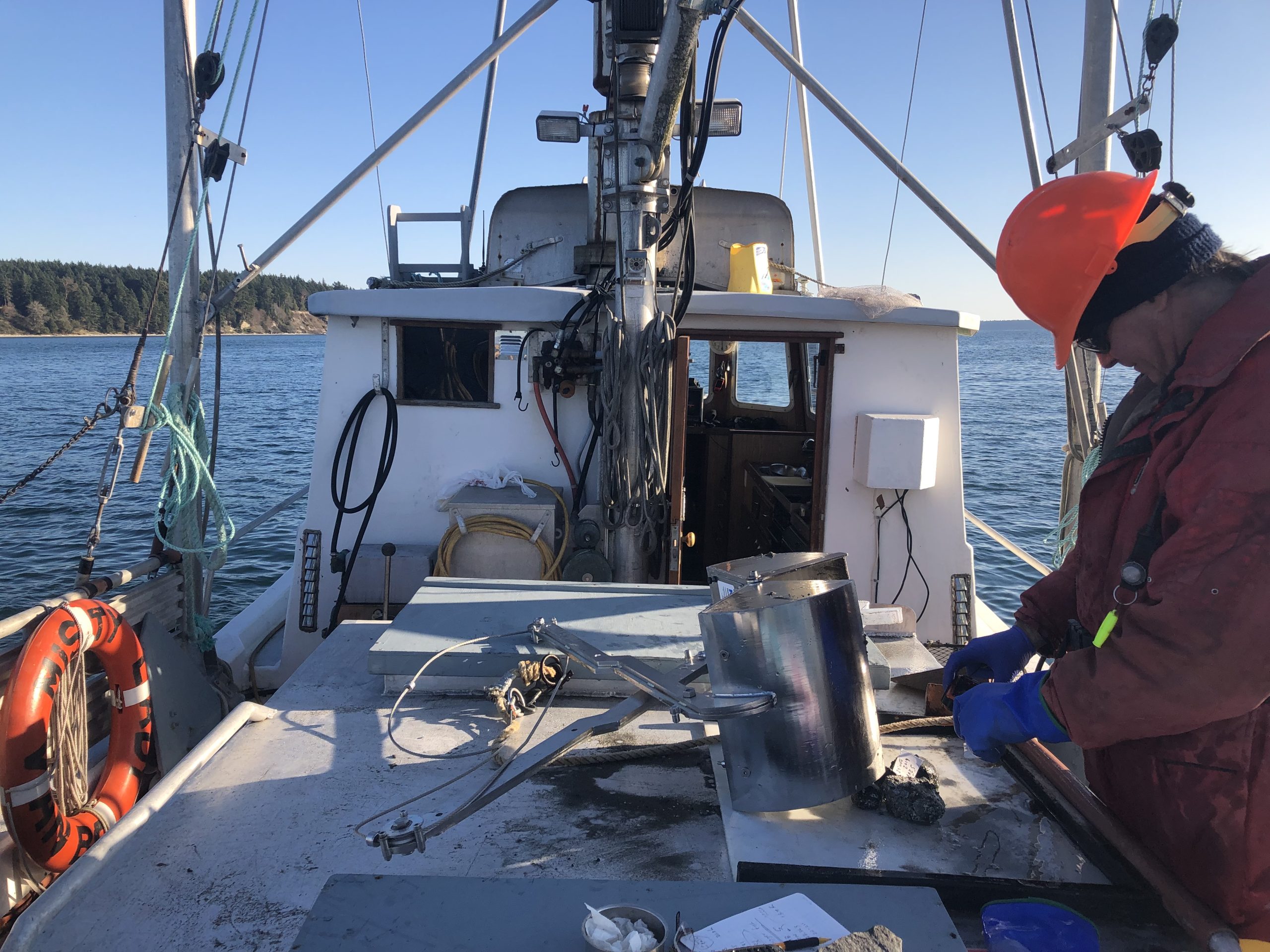
Collecting sand lance samples onboard the Misty Lady.
How to Apply
Please submit:
-
-
- A CV, including the e-mail and phone number for three references;
- A short cover letter explaining your motivation for working on this project and how your previous experience qualifies you for this position; and
- Copies of relevant research reports or publications (maximum 3)
to Maycira Costa (maycira@uvic.ca) and Project Watershed (info@projectwatershed.ca).
-
Please send questions to Jacqueline Huard (jacqueline.huard@projectwatershed.ca).
Equity and diversity are essential for academic excellence. An open and diverse community
fosters the inclusion of voices that have been underrepresented or discouraged. We encourage applications from members of groups that have been marginalized on any grounds enumerated under the B.C. Human Rights Code, including sex, sexual orientation, gender identity or expression, racialization, disability, political belief, religion, marital or family status, age, and/or status as a First Nations, Metis, Inuit, or Indigenous persons.


