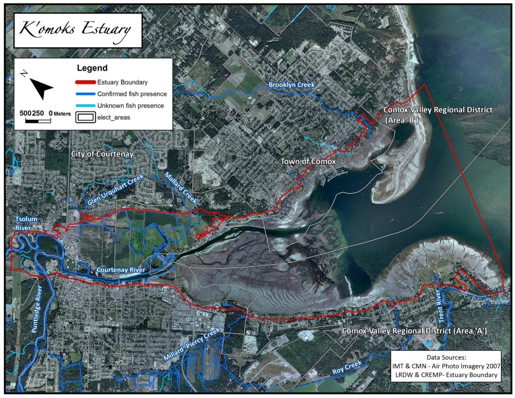
K’ómoks Estuary Boundary Map
It is geographically divided into four distinct political jurisdictions with no common agreement as to how the estuary should be protected for future generations.
Related Posts
Eelgrass Update
In the fall our restoration team surveyed the three eelgrass beds which were planted with the help of our volunteers back in June. The beds are looking healthy!
Kus-kus-sum: End of Season Wrap-up
Now that we have put the Kus-kus-sum site to bed for the winter, we wanted to give you all a little update on how things progressed this season – lots happened!
Kate McKeown
Meet our new Forage Fish Technician!
Greenshores at Dyke Road Park – Reimagining a Park
On September 20 and 21, over 20 people were on site to help with planting at the Comox Valley Regional District’s (CVRD) Dyke Road Park redevelopment project.
Gartley Beach Green Shores for Homes Project
Project Watershed is teaming up with the CVRD and the Stewardship Centre for BC to do some shoreline restoration at Gartley Beach in Royston.
Fall and Winter Forage Fish Sampling
We’re gearing up for the fall/winter season of forage fish sampling!


