The K’ómoks Estuary includes all land within the 200 year floodplain from Reese Bridge on the Tsolum and Condensory Bridge on the Puntledge. The Esturay also includes land within 100 meters from the high tide mark out to Goose Spit and Trent River.
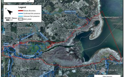
K’ómoks Estuary Boundary Map
read more