Kus-kus-sum Restoration Overview
The restoration will occur in 3 phases. Click below to read more about each phase and scroll down to see a visual representation of the site features found on the restored Kus-kus-sum site.
Phase I - Office and Hard surface removal
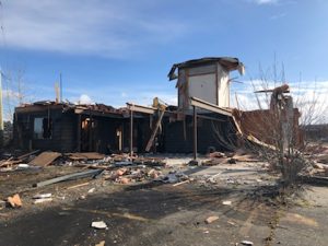
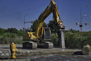
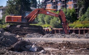
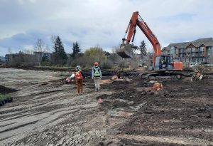
During Phase I the derelict office building and the hard surfacing were removed. This phase was initiated in February 2021 and completed in March 2022. The contractors for the first phase of the project were Copcan Civil Ltd. To allow for the removal of hard surfacing, they used an excavator to clear the vegetation growing on site. After the trees were removed Copcan worked with excavators and other heavy machinery from June 2021 to October 2021 to break up and remove the surface concrete and asphalt. As the surface material was removed, a few areas with additional sub-surface concrete were uncovered along with a concrete wall that was placed inside the steel wall. These items were removed in February and March of 2022.
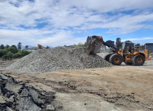
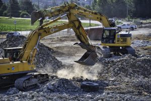
As the concrete was removed, excavators were used to separate out the rebar embedded in it. All removed concrete was crushed to be repurposed and used in projects throughout the Comox Valley.
Total Removed:
- 12,100 m3 of crushed concrete (reused – funds went back into the project)
- 34 bins of steel (recycled- funds went back into the project)
- 139 loads of asphalt
- various lengths of PVC piping (reused – funds went back into the project)
- 1 large 40-yard bin of wood waste
- 1 small 20-yard bin of garbage
Photo Credits:
1. Office Demolition ~ Caitlin Pierzchalski, 2. Breaking Concrete ~ Norm Prince, 3. Crushed Concrete ~ Caila Hollbrook, 4. Separating Concrete from Rebar ~ Norm Prince
Phase II - Earthworks and Planting
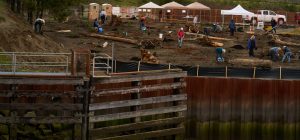
In this phase, the site was regraded to natural streamside elevations and native vegetation was planted. First, the new shoreline and the elevations for the site were surveyed in, then Leighton Contracting Ltd., a K’omoks Economic Development Corporation joint venture partner, excavated down to these elevations.
Some of the excavated soils were used on-site; however, the bulk of them were transported offsite. Most of the soils were found to be within compliance levels (deemed not contaminated) and could be reused. Any contaminated soils were moved to a permitted handling facility and reviewed by a 3rd party CSAP (Contaminated Sites Approved Professional).
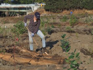
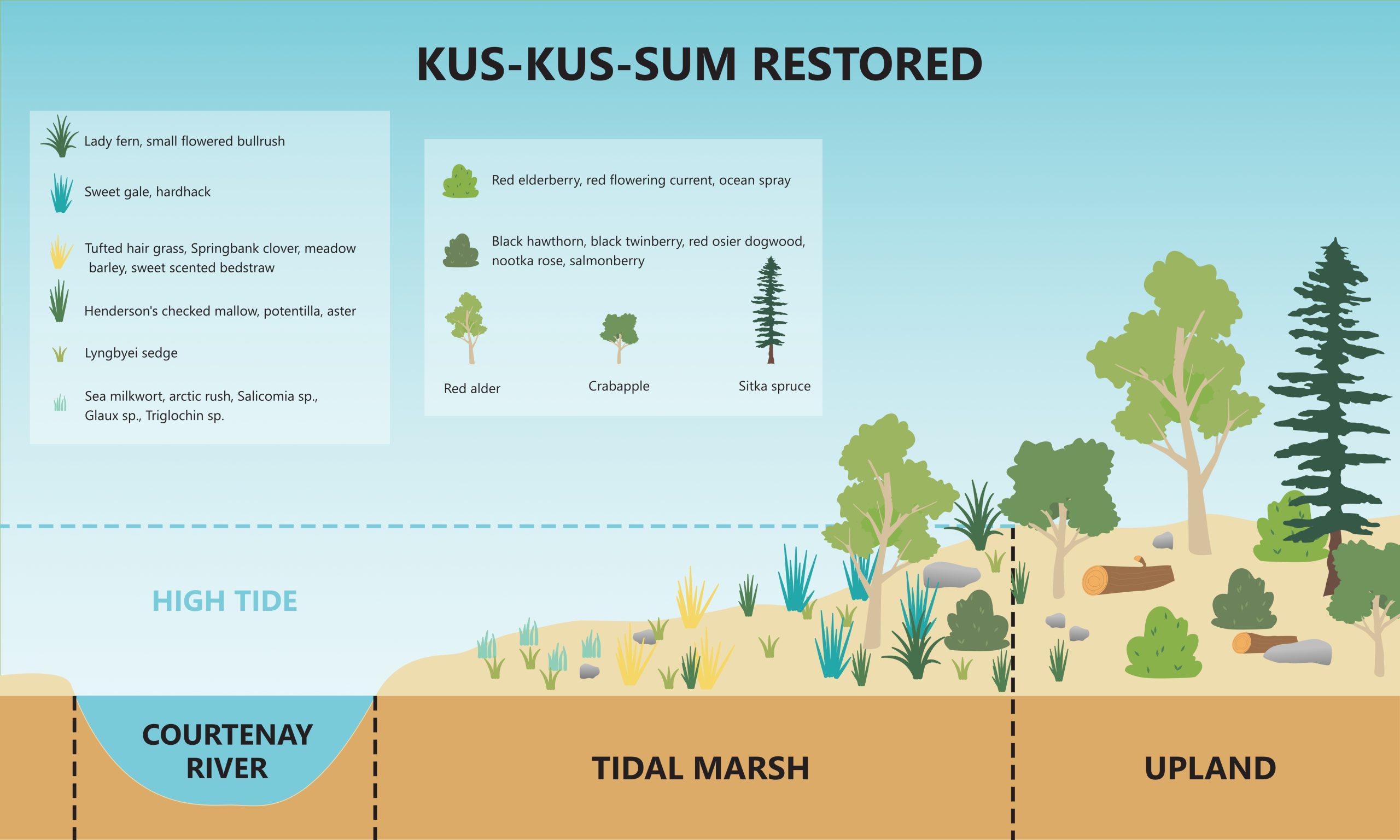
The restoration design was developed in partnership with Northwest Hydraulic Consultants. There will be an upland area along the road planted with native trees and shrubs; however, most of the site will be below the high tide line. Due to this tidal influence, salt marsh species, which are salt tolerant, will be planted below the shoreline. A salt marsh bench will run the length of the site and there will be an island with a deep pool behind it to the south providing deep water refuge for fish. A berm will be created along Comox Road to protect it from flood events. The Hollyhock flats area adjacent to the south end of the site will be used as a planting template. This phase was initiated in the summer of 2022 and is estimated to be completed at the end of 2023.
Photo credits:
1. Excavating soils ~ Laura Stewart, 2. Preparing Area for Planting ~ Caila Holbrook, 3. April Planting ~ Graeme Robertson, 4. October Planting ~ Anne Franklin
Phase III - Planting and Re-connecting to the River
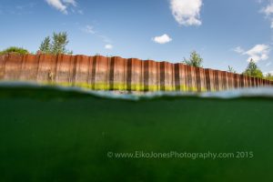
The main objective of this phase is to reconnect the site to the Courtenay River. This will entail removing the sheet metal wall that lines the site. A barge carrying an excavator with a special attachment will be moved upriver during an appropriately high tide. The excavator will vibrate the panels of the wall loose and they will be transported away to be recycled. This phase of the project will likely occur during the winter of 2024; however, the exact timing will depend on factors such the completion of our soil stabilization measures, the fisheries window and tide windows. Once the wall is removed the site will be inundated with water from the river and will be subject to tidal changes. This will mark the completion of the restoration of the site, however, Project Watershed inteds to continue monitoring and maintinging the site to assit with plant growth/site development and to evaluate the success of the project.
Restored Site Features
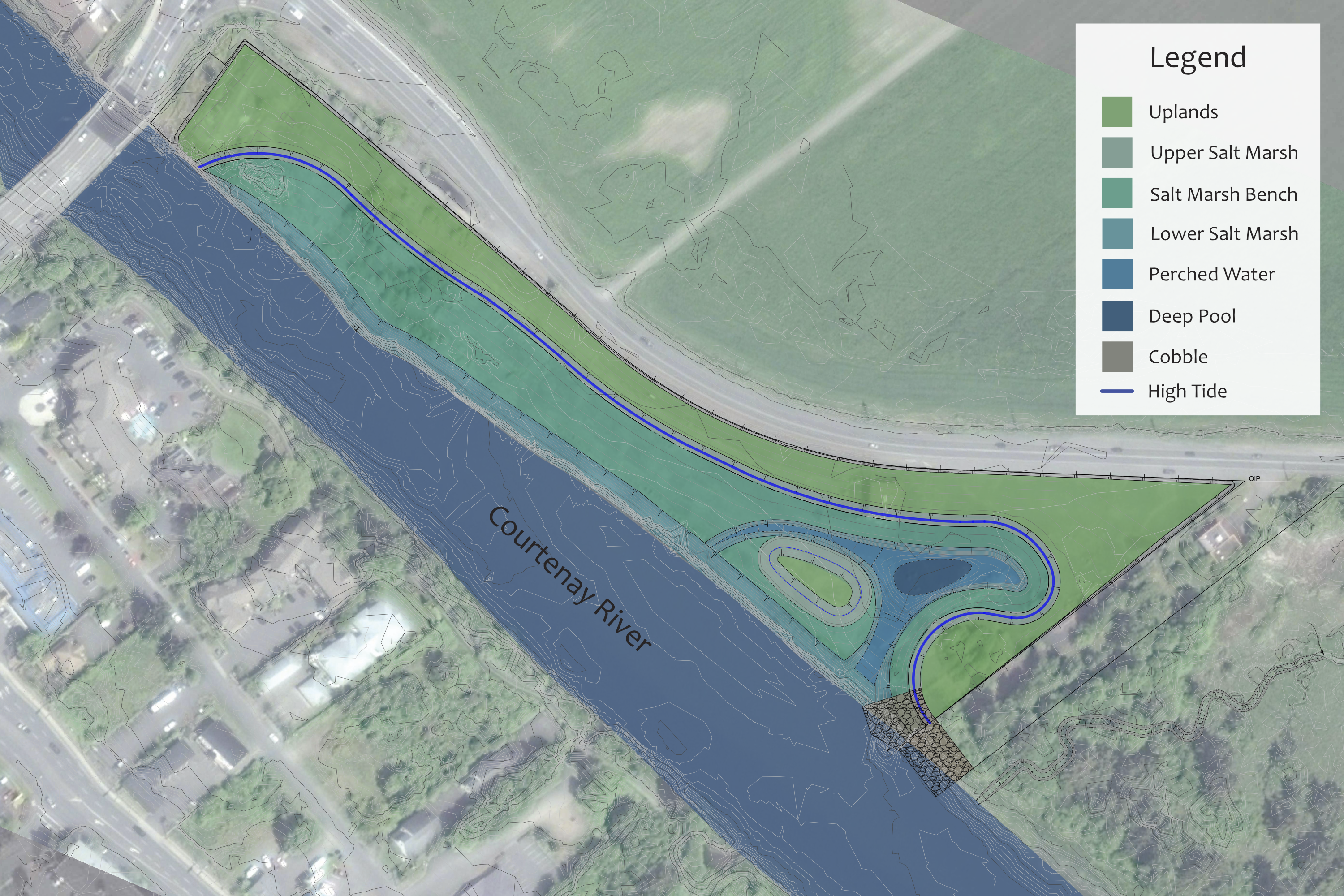


The interactive map above provides more detail about how each area of Kus-kus-sum will be restored. The cross-section of Kus-kus-sum restored (below) shows the planting plan according to the changing elevations of the site.
Hollyhock Flats, located south of Kus-kus-sum, has been used as a reference site; the Kus-kus-sum restoration plan mimics the terrain and habitat features that are found there, creating suitable conditions to allow planted and naturally recruiting native plant species to flourish. Habitat features include forested upland areas, saltmarsh benches, upland islands, tidal channels with large woody debris habitat complexing, and sloping transition areas. Carolla Environmental has provided the planting prescription based on final design drawings prepared by Northwest Hydraulic Consultants.
Cross section of the restored site
The above time-lapse was made possible by Luke from LSP Media. The photos used to create this time-lapse were generously provided by members of our community who utilized the photo station installed adjacent to the railing on the patio with the outdoor pool.
This photo station is open to all patrons of the Old House Hotel, and we encourage everyone to contribute photos to help us document the evolution of the restoration. With every photo contributed, we can create a comprehensive visual record of the changes taking place at Kus-kus-sum.


