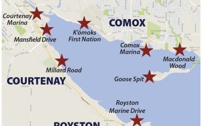
Welcome to the interactive map of the K’omoks Estuary. The video on this page gives some tips on how to interact with the map.
Interactive Estuary Map
read more
Working with the K’ómoks Nation towards Q’waq’wala7owkw on their unceded territory.
Working with the K’ómoks Nation towards Q’waq’wala7owkw on their unceded territory.
Welcome to the interactive map of the K’omoks Estuary. The video on this page gives some tips on how to interact with the map.
The K’ómoks Estuary Interactive Map will be an important tool in the protection and restoration of the estuary; and in the coming year we hope to build upon what we have developed so far. In this regard we would appreciate feedback on your experience with the map to help us improve its usability and usefulness.
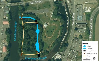
Over 2017- 2018, the Project Watershed team completed a habitat improvement project. The endeavour included the removal of an old culvert connecting the Courtenay River through the park into an inner pond area.
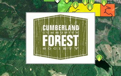
An informative, interactive map of the Cumberland Community Forest.
Directory of maps related to the Comox Valley.
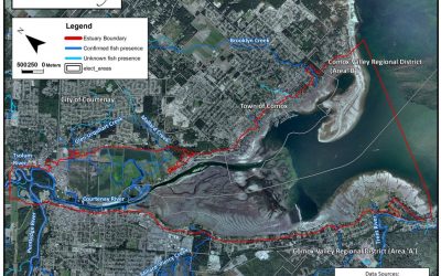
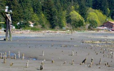
The K’ómoks Estuary includes all land within the 200 year floodplain from Reese Bridge on the Tsolum and Condensory Bridge on the Puntledge. The Esturay also includes land within 100 meters from the high tide mark out to Goose Spit and Trent River.
Maps of the K’omoks Estuary
This information complements that which appears on the sign that has recently been erected north of the Courtenay Marina on the Riverway Walk.
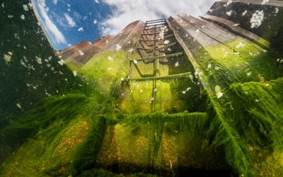
As part of our Estuary Stewardship, Project Watershed has committed to the restoration of the Field Sawmill site in partnership with the K’ómoks First Nation and City of Courtenay. We have been given a name for the site by the K’ómoks First Nation and are now calling it Kus-kus-sum.
Guided walking and kayaking tours showcasing green infrastructure in and around the Courtenay River were held on May 10 and 11, 2019. The tours were geared towards increasing political awareness of the possibilities of green infrastructure. Participants visited areas where green infrastructure was already in place or where it could be implemented in the future.
The information on this page complements that which appears on the sign that has recently been erected on Sandpiper Drive near Millard Creek.
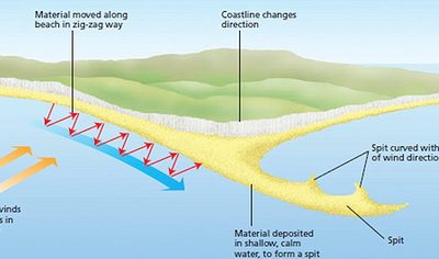
The information on this page compliments that which appears on the sign that has recently been erected on Goose Spit.