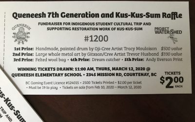
Congratulations and thanks to everyone who helped make this double raffle a success for Queneesh School’s Aboriginal program and for Kus-kus-sum!
Tickets for the Queneesh 7th Generation Indigenous Education Club Raffle
read more
Working with the K’ómoks Nation towards Q’waq’wala7owkw on their unceded territory.
Working with the K’ómoks Nation towards Q’waq’wala7owkw on their unceded territory.
Congratulations and thanks to everyone who helped make this double raffle a success for Queneesh School’s Aboriginal program and for Kus-kus-sum!
[av_two_third first min_height='' vertical_alignment='av-align-top' space='no_margin' margin='0px' margin_sync='true' padding='0px' padding_sync='true' border='' border_color='' radius='0px' radius_sync='true' background_color='' src='' attachment=''...
The Estuary Working Group was initiated as a sub-committee by Project Watershed following the “Heart of the Watershed” Symposium on Restoring the Courtenay River Estuary held in October, 2008. We are made up of 11 member organisations and individuals dedicated to protecting, conserving and restoring the diverse, productive and highly cherished K’omoks Estuary (name changed from the Courtenay River Estuary in January 2013).
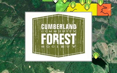
An informative, interactive map of the Cumberland Community Forest.
Directory of maps related to the Comox Valley.
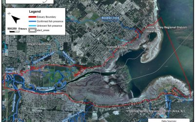
The K’ómoks Estuary includes all land within the 200 year floodplain from Reese Bridge on the Tsolum and Condensory Bridge on the Puntledge. The Esturay also includes land within 100 meters from the high tide mark out to Goose Spit and Trent River.
Maps of the K’omoks Estuary
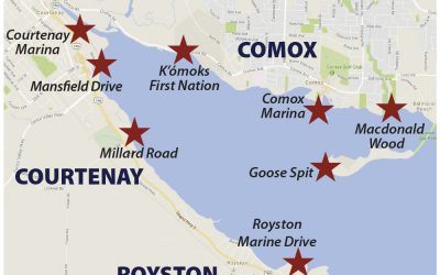
This information complements that which appears on the sign that has recently been erected north of the Courtenay Marina on the Riverway Walk.
Project Watershed extends our sincere thanks to the following funders and partners.
Director at Large
Technical Director
Director at Large